 Scheme Introduction
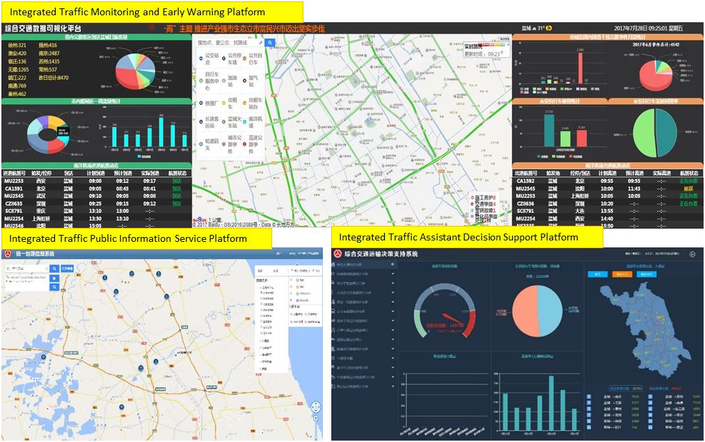
Collect various urban traffic information and build a comprehensive business platform covering comprehensive urban traffic operation monitoring and warning, emergency command and coordination, assistant decision support, public information service, video image management and overall operation and maintenance management. Through the integration and penetration of various business modules between platforms, provide comprehensive scientific decision support services for the government, comprehensive operation management services for enterprises, and comprehensive traffic information services for the public.
System Overall Structure Diagram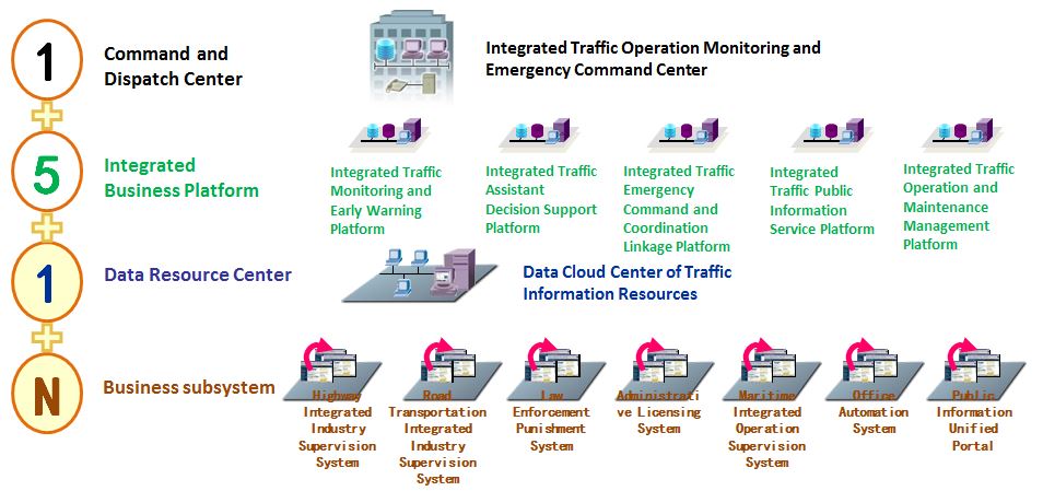
The system adopts 151N structure, and five integrated service platforms are driven by a dispatching center. The platforms share resources through a data resource center, and can access and support several business systems. This multi-modular system integration scheme is not only cost-effective, but also clear in module composition, easy to upgrade and increase functions, which is conducive to later system maintenance.
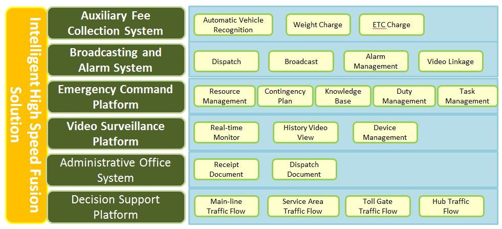
 Intelligent Dispatching of Highway
 The system adopts advanced communication and big data mining technology, and intelligently applies high-speed wireless communication, Lane cooperation, regional network collaborative management and tourism information service through the integration of highway toll collection, video surveillance, emergency command, administrative affairs and communication system. Intelligent network management, Lane sharing and tourism information service can help highway businessmen maximize management efficiency and economic benefits.
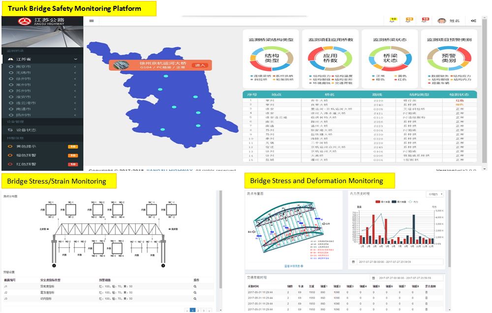
 Bridge Integrated Management
 The system applies new sensing technology to real-time monitor the structural deformation, temperature distribution and other parameters of the key parts of the bridge, and real-time warn the structural response of the bridge under various environmental and load factors. It provides an effective scientific basis for the maintenance and management of the bridge, and can significantly improve the overall management level of the bridge, thus ensuring the safety of the bridge to the greatest extent possible. Operation, pre-diagnosis of bridge diseases and extension of bridge service life.
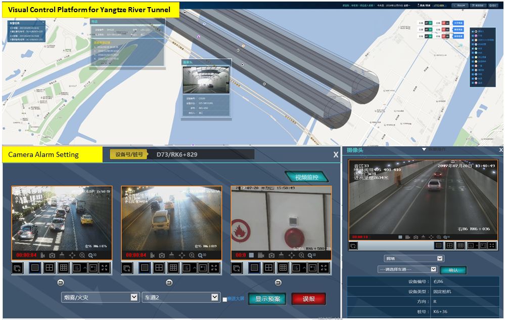
 Tunnel Integrated Management
 The system integrates all kinds of management elements and disaster prevention and maintenance means of tunnel. According to GIS and BIM IT, it sets up surveillance cameras, event detectors and control sensors to collect vehicle information, and obtains the information of traffic accidents in time. The control device is activated by control sensors, and the plan processing is implemented by model definition technology. Therefore, loss can be effectively controlled and minimized.
 Port Integrated Management
 The system integrates all kinds of port resources and extensively shares them to create a "map of port resources". It realizes the marking and display of the specific location of the port, port area, operation area, business dealers, wharf berth, anchorage and shoreline on the map. It can accurately locate the equipment status of hazardous chemicals enterprises and related facilities in the port area and draw the electronic distribution map of hazardous chemicals enterprises in the port.
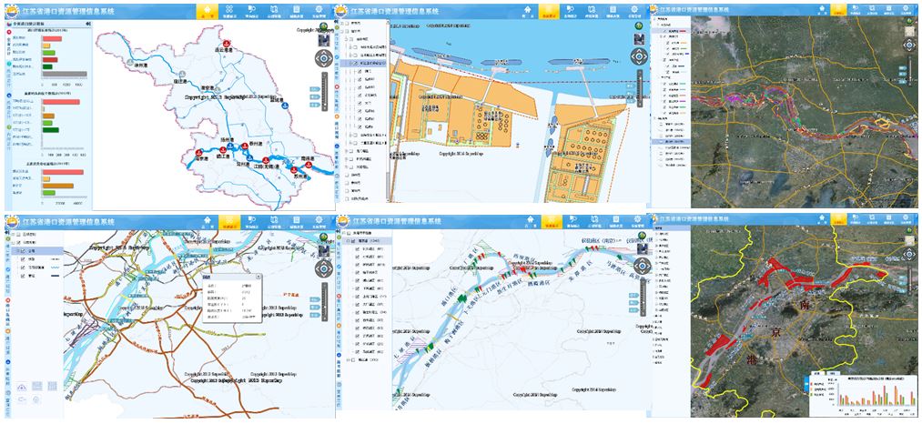
AIS technology is used to collect dynamic and static information of ship's course, speed, position, identification code, and so on. The ship's dispatching arrangement, operation management and emergency command management are realized, so as to effectively improve the efficiency of real-time monitoring and law enforcement of the aquatic administrative department. From the accident information alarm, accident location graphics, to the surrounding field analysis, emergency rescue command, a clear hierarchy, rapid linkage, effective command port command platform has been formed.